Edo Keicho Map (Keichō Edo Ezu)
Tokyo Shiryō Collection A11-1
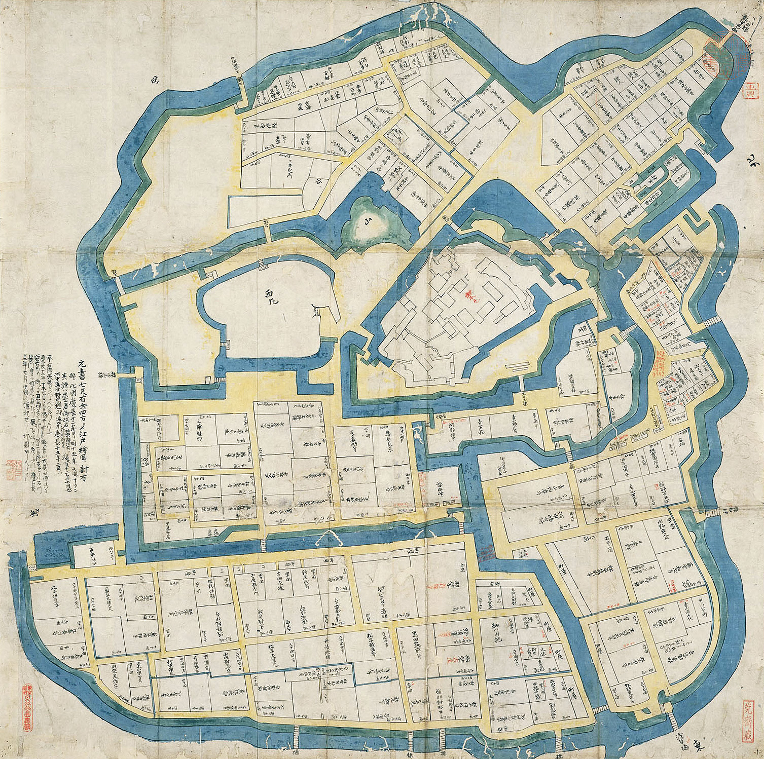
This is considered to be an accurately scaled illustration of the area around Edo castle as well as the castle grounds around 1608 (Keichō 13), shortly after Ieyasu formed the Shogunate in Edo.
A precise map of Edo as shown in this illustration does not appear in "The Manji Period Edo Survey Map (otherwise known as the Meireki Survey Map)" (Mitsui Library) said to be made as a survey map of Edo immediately after the Great Fire of Meireki in 1658 (the first year of Manji) and "New Illustration of Ōedo" (otherwise known as Five Illustrations of Aya Futuka held in this library) but is viewed only as a pictorial illustration.
This illustration, considering its precision and its depiction of the main house from the front gate, is considered to have been finished some years later. The contents resemble more closely a castle map than an Edo map and this also indicates the great importance of this piece.

